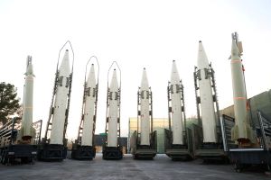
Iran says foreign GPS systems unsafe, eyes national satellite network
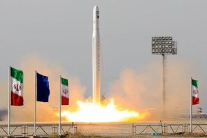
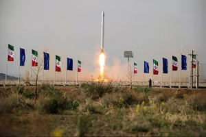
The "Simorgh" satellite carrier launched at an undisclosed location in Iran, in this handout image obtained on December 6, 2024. I
The head of Iran’s Space Research Center said on Tuesday that foreign global positioning systems (GPS) are not secure and that the country must develop its own national satellite navigation network to reduce dependence on foreign providers.
Vahid Yazdanian, who leads the Space Research Center under the Ministry of Communications, told the state-run ILNA news agency that GPS disruptions in Iran stem from the absence of indigenous navigation satellites.
He said Iran currently lacks any navigation satellites, relying instead on foreign systems.
“No global navigation system can be fully secure,” he said. “The ultimate solution is to develop a domestic satellite navigation constellation.”
Yazdanian added that the country needs to build its own infrastructure to secure applications ranging from urban transport to the navigation of trains, ships and aircraft.
He also pointed to broader uses of space technology, saying that Iran’s Earth observation satellites already provide images that help policymakers estimate crop yields and manage water resources.
According to Yazdanian, satellite imagery has allowed the government to monitor wheat, barley, maize and potato production, and to make decisions about imports or domestic procurement.
The comments come as Iran pushes ahead with an ambitious space program. The head of the Iranian Space Agency said earlier this month that Tehran plans to launch four satellites by March 2026 and begin operations at its new spaceport in Chabahar, on the country’s southeastern coast.
Among the planned launches are the Zafar, Paya, and a second model of the Kowsar Earth observation satellite, along with test units of the Soleimani narrowband communications constellation.
Western governments have repeatedly voiced concern that Iran’s satellite program could advance ballistic missile technology. Tehran says its activities are for peaceful purposes, adding the satellites will support civilian applications such as communications, agriculture and environmental monitoring.
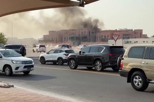
File photo shows an Iranian police vehicle in Tehran.
Armed men opened fire on a police vehicle in Sistan-Baluchestan province, killing at least two officers, Iranian state media reported on Tuesday.
The attack happened on the main highway between Zahedan, the provincial capital, and the town of Khash, in the district of Sib and Sooran, according to local media.
State outlets reported two police officers were killed, while the Baluch rights group Haalvsh put the toll at three. Large numbers of security forces were sent to the area after the shooting, residents told the group.
The attackers have not been identified and no group has claimed responsibility.
Restive province sees repeated bloodshed
The southeastern province, bordering Pakistan and Afghanistan, has long been one of Iran’s most volatile regions. Earlier in September, gunmen shot dead a Revolutionary Guards intelligence commander, Iraj Shams, in the town of Pishin. Local reports said he was killed inside a barbershop in the city market.
Authorities have accused Sunni militant groups of carrying out attacks in the area. The group Jaish al-Adl, designated as a terrorist organization by both Iran and the United States, has claimed responsibility for past assaults.
In late August, the Guards said they killed eight armed men during operations in Iranshahr, Khash and Saravan, and freed one hostage. One Guards member was killed and another wounded in those clashes.
The province has also been the scene of deadly incidents involving Afghan migrants. On September 8, Iranian border guards opened fire on a group of around 120 Afghans crossing into Golshan district, killing six and wounding five, Haalvsh reported.
The group, which included women and children, came under fire from both light and heavy weapons, the rights group said. About 40 others were detained. Human Rights Activists News Agency, a US-based monitor, described the shooting as a breach of international law.
Iran has stepped up deportations of undocumented Afghans, expelling nearly 1.8 million over the past year. The United Nations has warned of a looming humanitarian crisis from mass returns.
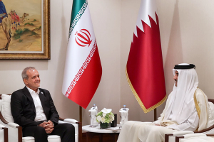
Iran’s Foreign Minister Abbas Araghchi addressing the Iran-Economic Cooperation Organization (ECO) conference in Tehran on September 16, 2025
Iran’s Foreign Minister Abbas Araghchi said on Tuesday that possible negotiations with the United States will hinge on Washington’s readiness for a deal based on mutual interests without threats or intimidation, not on which regional state mediates.
“Several countries in the region are trying to play a positive role, not only Qatar,” Araghchi told reporters at the opening of the second Iran-Economic Cooperation Organization (ECO) conference.
“But for starting negotiations, the question is not the mediator. The important point is the will of the other side. Whenever they accept that a deal must be based on mutual interests, without threat and intimidation, the rest are details.”
Araghchi used his speech to warn against what he called unchecked unilateralism and said the world needed to strengthen multilateral alliances.
“Today, more than ever, the world is faced with reckless unilateralism. This worrying trend has made the international order more fragile and posed serious challenges to security,” he said.“Cooperation among developing countries in multilateral formats is no longer a choice but a necessity.”
A scene from Iran-Economic Cooperation Organization (ECO) conference in Tehran on September 16, 2025
He said Iran had been a “victim of America’s unjust unilateralism and Israel’s dangerous adventurism” but would continue to act as an active regional player through bodies such as ECO.
Tehran and other member states are drafting a 10-year vision for the group until 2035 to expand its role in regional development, he said.
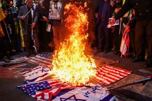
Turning to regional politics, Araghchi said this week’s emergency Arab-Islamic summit in Doha had highlighted a consensus on Israel as the main security threat.
“What the Islamic Republic of Iran has been saying for years -- that the Zionist regime is the main threat to the region and its aggression has no end -- has now become an undeniable truth for everyone,” he said.
He added that Iran welcomed the regional convergence and called for “collective movement and unity among all countries in the region” to respond.
On Monday, Iran’s foreign ministry rejected references to a two-state solution for the Israeli-Palestinian conflict in the final communique of the Arab-Islamic emergency summit in Doha, saying the approach would not resolve the issue and accusing US policies of sustaining Israeli aggression.
On the South Caucasus, Araghchi said disputes such as the Zangezur corridor remained complex and should be settled by regional states.
“The United States has not contributed to lasting peace in the region,” he said. “Our recommendation is regional mechanisms, and the Islamic Republic has proposed the 3+3 format.”
Araghchi and President Masoud Pezeshkian are due to attend this month’s United Nations General Assembly, which the minister described as an important platform for “conveying the voice of the Iranian people to the international community.”
Opening of the International Atomic Energy Agency (IAEA) General Conference at the agency's headquarters in Vienna, Austria, September 15, 2025.
Iran and five other countries have submitted a draft resolution to the International Atomic Energy Agency’s annual general conference calling for a ban on any attack or threat of attack against nuclear sites under UN safeguards, Iran’s foreign ministry said on Tuesday.
Foreign ministry spokesperson Esmaeil Baghaei said on X that the text, backed by China, Russia, Venezuela, Nicaragua and Belarus, was intended “to defend the integrity of the NPT” and reaffirmed the inalienable right to develop nuclear energy for peaceful purposes.
“All states must refrain from attacking or threatening to attack peaceful nuclear facilities in other countries,” Baghaei wrote. “These principles must be upheld; it is high time that the international community acted firmly to prevent the normalization of lawlessness.”
Draft resolution
The draft resolution condemns “the deliberate and unlawful attacks carried out in June 2025 against nuclear sites and facilities of the Islamic Republic of Iran,” calling them clear violations of the UN Charter and the IAEA Statute.
It says nuclear sites under IAEA safeguards “shall not be subject to any kind of attack or threat of attack,” adding that such actions pose serious risks to international peace and security, human health, the environment, and the credibility of the non-proliferation regime.
The document also recalls UN Security Council Resolution 487 of 1981, which condemned Israel’s bombing of Iraq’s Osirak reactor, and reaffirms previous IAEA decisions prohibiting attacks on safeguarded facilities.
It further stressed that all questions regarding nuclear programs should be resolved “exclusively through dialogue and diplomacy, as the only viable path.”
Israel launched a surprise military campaign on June 13 targeting Iranian nuclear and military sites, including senior commanders and nuclear officials in a conflict that lasted 12 days. On June 22, the United States joined the campaign, striking nuclear facilities in Fordow, Natanz and Isfahan. Washington brokered a ceasefire on June 24.
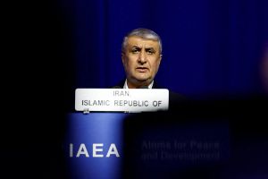
Iran’s nuclear chief Mohammad Eslami told the conference on Monday that Tehran’s atomic program “cannot be eliminated through military action,” accusing Israel and the United States of launching illegal strikes on Iranian sites in June.
“Despite our formal request, the agency did not condemn the attacks by the United States and Israel on the nuclear centers of the Islamic Republic,” Eslami said, calling the IAEA’s silence “a stain on the Agency’s history.”
Eslami said Tehran would use the conference to highlight what he called unlawful measures against its nuclear industry and to push for adoption of the draft.
The debate comes as Iran’s recent cooperation deal with IAEA chief Rafael Grossi awaits implementation and European powers press ahead with the UN “snapback” mechanism that could reinstate sanctions on Tehran by late September.
Qatar's Prime Minister and Minister for Foreign Affairs Sheikh Mohammed bin Abdulrahman bin Jassim Al-Thani, attends the preparatory ministerial meeting for emergency Arab-Islamic summit in Doha, Qatar September 14, 2025.
Iran rejected references to a two-state solution for the Israeli-Palestinian conflict in the final communique of the Arab-Islamic emergency summit in Doha, saying the approach would not resolve the issue and accusing US policies of sustaining Israeli aggression.
“Iran reiterates that the so-called two-state solution will not solve the Palestinian issue,” the Foreign Ministry said in a statement carried by state media. “The only real and lasting solution is the establishment of a single democratic state through a referendum with the participation of all Palestinians, inside and outside the occupied territories.”
It added that Tehran “disassociates itself from any reference to this concept and similar notions, including East Jerusalem, the 1967 borders and related terms, mentioned in the communique.”
The ministry reaffirmed support for what it called the “inalienable right of the Palestinian people to self-determination” and condemned “brutal crimes” by Israel.
“The people of Palestine have the right to use all necessary means to exercise their right to determine their destiny and free themselves from foreign colonial occupation,” it said.
The Iran-backed Houthis of Yemen echoed similar criticism, dismissing the communique as empty rhetoric and calling for stronger action. Mohammed Ali al-Houthi, a senior member of the group’s supreme political council, said “a simple and tiresome statement of condemnation will not prevent the crimes of the occupiers.”
While praising mediation efforts by Qatar and Egypt, Tehran said, “US policies and actions in practice sustain and support the aggressions of the Israeli regime against the Palestinian people. Therefore, the United States cannot be regarded as a credible or impartial party in advancing a just and lasting peace.”
The Arab-Islamic summit, convened in Doha this week after Israel’s September 9 strike on Qatar, denounced the attack as a violation of international law and expressed full solidarity with Doha.
Leaders said Israel’s “crimes of genocide, ethnic cleansing, starvation and siege” undermine prospects for peace, and reaffirmed support for the Arab Peace Initiative and international resolutions backing a two-state solution with East Jerusalem as the Palestinian capital.
Iran requested that its reservations be recorded in the summit’s final report.
IAEA chief Rafael Grossi and Iranian Foreign Minister Abbas Araghchi sign an agreement to advance resumed nuclear inspections in a ceremony in Cairo, Egypt on September 9, 2025.
Iranian ultra-hardliners are criticizing Tehran's recent agreement with the IAEA in Cairo, despite its blessing by a top decision-making body linked to the Supreme Leader, but an outlet linked to the Revolutionary Guards offered support.
The scrambled messaging suggests deep disagreement on Iran's diplomatic path forward as renewed UN sanctions loom by months-end and arch-foe Israel continues to moot military attacks to chasten Tehran.
Negotiated by Foreign Minister Abbas Araghchi, the Cairo deal addressed an impasse between the UN nuclear watchdog and Tehran after the latter refused to let inspectors resume work following surprise US and Israeli attacks on Iranian nuclear sites in June.
While ultra-hardliners warn it risks national security, supporters insist the agreement reflects careful diplomacy rather than a threat to sovereignty.
Iranian lawmakers convened an emergency meeting with Araghchi on Saturday to review the agreement.
The Supreme National Security Council released a statement shortly after the session announcing that the deal aligns with its nuclear committee’s prior approval, emphasizing that submission of reports on facilities targeted by US and Israeli attacks, and any further operational procedures, would require SNSC authorization.
“While the government emphasizes the legal frameworks and the Supreme National Security Council’s approval for the agreement with the IAEA, ultra-hardliners are using media campaigns to try to disrupt the decision-making process,” independent news outlet Rouydad24 wrote.
Supremo stamp sought
“Araghchi claims he has authorization from the Supreme National Security Council to negotiate (with the IAEA) … and (claims) that the council’s decisions are also endorsed by the Supreme Leader,” hardline MP Ahmad Bakhshayesh, a staunch critic of the IAEA deal and the 2015 nuclear agreement, told Rouydad24.
Mojtaba Zarei, a member of parliament’s National Security and Foreign Policy Committee, posted on X that Araghchi “has acted fully within the country’s legal and strategic framework, and never unilaterally.”
His negotiations, Zarei added, have followed the Supreme Leader’s policies, the Supreme National Security Council’s guidance and recent parliamentary laws, without exceeding his authority or granting IAEA inspectors unrestricted access.
NPT in the crosshairs
Ultra-hardliner lawmakers, having recently passed a high-priority bill that could lead to Iran’s withdrawal from the Nuclear Non-Proliferation Treaty (NPT) and halting cooperation with the IAEA, continue to challenge the agreement.
Hamid Rasaei, an ultra-hardliner lawmaker, insisted in a video posted on X that contrary to what Araghchi told lawmakers, the deal could not block the reimposition of UN sanctions under the snapback mechanism.
“If this agreement bypasses the law, involves violations, or represents a deviation, we will uphold and defend the law,” another ultra-hardliner lawmaker, Eshareh Azizi, threatened.
Ultra-hardliners also say the agreement risks exposing sensitive nuclear sites.
“Technical agreements with the IAEA could be used as a cover for intelligence gathering, preparing the ground for a new attack on Iran, and creating a legal-political framework to increase sanctions pressure,” Kayhan newspaper funded by the Supreme Leader’s office alleged in an editorial on Monday titled “Europe Will Not Lift Sanctions, Don’t Be Deceived by the IAEA”.
The editorial suggested that leaving the NPT “remains one of the (most) viable options to change the game in Iran’s favor.”
IRGC outlet defends the deal
But a commentary by Basirat, an outlet affiliated with the IRGC’s political bureau, described the Cairo agreement as “a vital achievement in managing the nuclear file at its most sensitive juncture” and “a success.”
“The agreement prevented a new resolution against Iran and created breathing space for continued negotiations,” the commentary titled “Cairo Deal: Redefining Iran's Relations with IAEA” asserted.
Noting that the agreement distinguishes targeted nuclear facilities from others, allowing Iran to manage oversight and safeguard security concerns, it concluded that the deal can be seen as “a valuable opportunity to reduce tensions and return to the path of dialogue.”