Iran port blast leaves massive crater, new satellite images show
New satellite imagery obtained by Iran International shows a huge crater left by the April 26 explosion at Iran's Rajaei port, which killed at least 70 people according to official figures.
According to the photos take on April 30, the large crater has been formed in front of the administrative building of Sina Marine and Port Services Development Company, which was the epicenter of the explosion.
Epicenter of explosion in front of the administrative building of Sina Marine and Port Services Development Company
In the images, the complete destruction of the building—located in the northwest section of the compound—can be also clearly seen, along with the adjacent warehouses and at least three other buildings. The trees in the area also appear to be completely burned.
Destruction of buildings adjacent to Sina Marine and Port Services Development Company
The images also show a large number of shipping containers crushed on both sides of the explosion site, highlighting the extent of the destruction.
Crushed containers belonging to Sina Company
Iran International had previously reported that the 15-hectare Sina yard, which could accommodate between 12,000 to 20,000 twenty-foot containers, was entirely destroyed. The latest satellite photos confirm the previous report.
Complete destruction of Sina Company's 15-hectare yard in comparison with a photon taken a month before the explosion
The new images also reveal the total destruction of a large administrative building in the nearby Onik yard, located to the north of the Sina area. Damage to this building has not been previously reported.
Complete destruction of a large administrative building in the Onik yard
Khazar Qeshm Company: 10 hectares
To the west of the Sina yard lies the yard of Khazar Qeshm Company, with an area of 10 hectares, which has been almost completely destroyed. The images show that the roof of the company’s warehouse, which is located approximately 500 meters from the explosion's epicenter, has been completely torn apart.
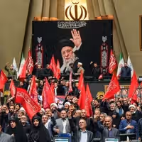
The three Iranian newspapers closest to the heart of power have adopted a maverick stance against talks with Washington, signaling that the theocracy's most powerful institutions remain deeply skeptical of diplomacy with their arch-nemesis.
While the Culture Ministry, the Supreme Council of National Security and the Press Supervisory Board issue ad hoc directives to newspaper editors about what to publish, three newspapers consistently defy those and often escape with a gentle caution.
They are Kayhan, Javan and Vatan-e Emrooz, linked respectively to the Supreme Leader’s office, the Islamic Revolutionary Guard Corps (IRGC) and the ultraconservative Paydari Party, all of which continue to criticize the negotiations with the United States – in apparent disregard of the highest office of the realm.
Earlier this week, Kayhan, known for its staunch anti-Americanism, attacked those who back talks with Washington, accusing them of turning a blind eye on the harm done to Iran by US sanctions.
"Why should we trust Trump, a man even his allies do not trust," the paper asked, using some unusually provocative language to describe Israel’s prime minister Benjamin Netanyahu.
Ultraconservative daily Vatan-e Emrooz also cautioned in its editorial against advancing the talks in a way that would make withdrawal or retreat from any agreement impossible.
The negotiating team should be wary of leaving Iran vulnerable to exploitation, the editorial warned.
The admonitions and the critiques may not be as harsh as they were a couple of weeks ago – prior to Khamenei’s cryptic backing of negotiations. But the very fact that they keep flowing after the leader’s blessing of diplomacy is significant.
"Speaking without restraint at times ... our unnecessary objections, our lack of patience, and our flawed analyses of situations can have historical consequences,” Khamenei cautioned last week with no direct reference to the ongoing negotiations.
“Therefore, we must be very careful," he said. But the trio appear to have not received the memo. Or maybe they have.
The three dailies not only represent powerful factions within the Islamic Republic’s polity, but they also enjoy direct access–with varying degrees–to Khamenei’s office.
It may be easier, therefore, to explain their editorials as necessary objections, contingencies for a potential policy shift should the interests of the leadership require one.
No surprise, perhaps, that IRGC-linked Javan, the daily closest to and representing actual power, has shown the most balanced approach to the negotiations in recent weeks.
"Iran may wish to maintain its image as an anti-imperialist warrior. But who says an agreement limited to eliminating sanctions against reducing enrichment levels will tarnish that image,” Javan asked in an editorial this week.
"We have done this before. Why shouldn't we do it again...? No country in the world will characterize this as Iran relinquishing its ideals."
Unlike other outlets in Iran, which face severe consequences for minor errors, these three dailies roam carefree on the theocracy’s political plane. Whether or not their tone is part of a grand strategy by the topmost officialdom remains unknown.
"Some say that Trump is unpredictable,” Javan concluded its editorial. “Well, we are not that predictable either!"
Iran’s security forces shot and killed a man protesting against the death penalty outside Fajr Prison in the southwestern city of Dezful on Wednesday night, sources familiar with the matter told Iran International.
Azim Farrokhond, a local resident, was demonstrating against the execution of one of his relatives when he was fatally shot, the sources said.
Special forces stormed the gathering, they added, injuring several protesters and arresting others.
The protest coincided with the executions of two prisoners, Karim Farrokhond and Mahmoud Ostadmamzayi, who had been sentenced to death for armed robbery.
Although the prisoners' sentences had been suspended several times, sources said the executions were carried out.
A picture showing former Syrian President Bashar al-Assad meeting with Iran's Supreme Leader Ali Khamenei, lies at a hotel used by Iranians under former Syrian President Bashar al-Assad's regime, near the Sayyida Zaynab shrine, in Damascus, Syria, December 14, 2024.
Iran’s multi-billion-dollar bid to rebuild postwar Syria and cement long-term influence has collapsed following the ouster of President Bashar al-Assad, according to documents obtained by Reuters from Tehran’s ransacked embassy in Damascus.
Modeled on the US Marshall Plan that helped rebuild post-WWII Europe, Tehran’s strategy sought to create political and economic dependency through reconstruction projects, religious diplomacy, and trade.
A 33-page Iranian policy study found in the looted embassy explicitly referenced America’s postwar blueprint, describing Syria as a "$400 billion opportunity" for Iran.
Instead, with Assad deposed by rebel forces in December and exiled to Russia, Iran’s assets in Syria were swiftly dismantled. Embassies were looted, paramilitaries withdrawn, and dozens of projects—including power plants, religious sites, and railways—abandoned.
Pieces of shredded documents are scattered on the floor of the Iranian embassy in Damascus, Syria, December 16, 2024.
Reuters reporters uncovered contracts, correspondence, and financial records showing Iran’s deep economic footprint and how it unraveled amid Western airstrikes, corruption, and internal mismanagement. The news agency used artificial intelligence tools to analyze nearly 2,000 documents.
One key project, a €411 million Latakia power plant built by Iran’s Mapna Group, remains half-finished. Other efforts, such as an oil venture in eastern Syria and a $26 million Euphrates rail bridge, were destroyed or halted. At least $178 million in unpaid debts to Iranian firms remain, though estimates of total losses exceed $30 billion.
The collapse comes as Iran faces regional setbacks, including heavy losses among its allies Hezbollah and Hamas, and growing diplomatic pressure from the US.
An exterior view of the abandoned Iranian embassy in Damascus, Syria, December 16, 2024.
“The Syrian people have a wound caused by Iran, and we need a lot of time to heal,” said new Syrian President Ahmed al-Sharaa, a former rebel leader, in an interview.
Iran’s foreign ministry declined to comment. Many Iranian officials involved, including Revolutionary Guard commander Abbas Akbari, did not respond to Reuters' inquiries.
For Syrians who worked on Iran-backed projects, the exit is bittersweet. “Iran was here, that was just the reality, and I made a living from it for a while,” said a Syrian engineer who worked on the stalled Latakia project.
A picture of Iran's Supreme Leader Ali Khamenei hangs on a wall in the Sayyida Zaynab neighborhood, in Damascus, Syria, December 14, 2024.
Labor Day in Iran was marked by demonstrations by teachers and heightened security in several cities across the country with allegations of violent suppression of protesters by security forces.
A group of active and retired teachers gathered outside the Ministry of Education headquarters in Tehran on Thursday to mark International Workers’ Day.
The protest, organized by the Coordinating Council of Iranian Teachers' Trade Associations, was met with a heavy security response.
According to a statement from the council, “Security forces violently dispersed demonstrators,” preventing any photography and arresting an unspecified number of participants.
“The security atmosphere was so heavy that even the right to take pictures was denied,” the group said. “Teachers were beaten and forced to leave.”
Similar gatherings were reported in other cities under tight security. Authorities did not immediately comment on the reported arrests or use of force.
Meanwhile, Iranian government officials sought to reassure workers facing mounting economic hardship in a bid to calm tensions.
Iranian government spokeswoman Fatemeh Mohajerani
Government spokeswoman Fatemeh Mohajerani acknowledged the ongoing economic challenges, citing recent inflation estimates and the impact on workers’ purchasing power as two thirds of the country now live below the poverty line.
She also announced the government’s intention to maintain healthcare coverage for 75 days after insurance cancellation — a policy seen as crucial for many precarious workers.
Mohajerani also addressed wage concerns, saying that although a 45% increase in minimum wages was approved by the Supreme Labor Council for the current Iranian year that started on March 21, “inflation has eroded much of that gain.”
The minimum salary of Iranian workers is about 100 million rials, about $125 at today’s rate. The inflation rate in Iran is about 45%, according to official data, with prices of food and housing increasing at higher rates.
To mitigate the impact on lower-income households, she said the government continues to promote “remedial policies” such as food coupons and subsidies for vulnerable groups, including mothers and pregnant women.
On pension reform, Mohajerani said the second phase of salary adjustments for retirees would proceed as outlined in the national budget. “The government is legally bound to fulfill its obligations, even if at times delays occur due to unforeseen conditions,” she added.
In a nod to one of the long-standing demands of workers, Mohajerani highlighted government efforts to improve access to housing. “Agreements have been made between the Ministry of Roads and Urban Development and industrial zones to help workers live closer to their workplaces,” she said.
She also addressed delays in the passage of legislation to organize public employment contracts, noting the complexity of balancing workforce rights with the legal mandate to limit the size of government under Iran’s development plan. “The government's approach is to support the private sector rather than expand itself,” she said.
On the broader economic picture, labor economist Alireza Heidari said taming inflation remains the number one priority for workers, who have been protesting ever worsening conditions in recent years. Complaints include wage cuts, unpaid wages and worsening working conditions.
“In recent years, workers’ livelihoods have become directly tied to inflation,” he told ILNA. “The vast majority of wage earners fall within the seven lowest-income deciles of society, and they have been hit hardest.”
He warned that recent wage increases may be neutralized by future price hikes. “We ended last year (March 20) with the (exchange rate for one) dollar hovering at 1,000,000 rials. If this affects prices further, even a 45% wage increase won’t prevent a real income decline.”
Heidari stressed that structural reforms are essential to curbing inflation. “Experience shows that inflation in Iran is largely driven by the government’s lack of financial discipline,” he said. “Though the new administration is making efforts, the challenge is deeply structural.”
He cautioned against linking economic mismanagement solely to external factors or international negotiations. “Some officials try to attribute all issues to foreign policy, but many of the problems are internal and systemic.”
He said that without tackling inflation, any other policy amendments are redundant. “We talk about insurance, safety, and union rights, but it all comes back to the issue of livelihoods,” he added.
US Defense Secretary Pete Hegseth speaks next to President Donald Trump, in the Oval Office at the White House, in Washington DC, March 21, 2025.
US Defense Secretary Pete Hegseth on Wednesday said Iran had continued to support Yemen's armed Houthi movement despite an explicit warning from Washington and vowed unspecified consequences for Tehran.
Pete Hegseth wrote on X: "Message to IRAN: We see your LETHAL support to The Houthis. We know exactly what you are doing. You know very well what the US Military is capable of — and you were warned."
"You will pay the CONSEQUENCE at the time and place of our choosing."
Hegseth also reposted a message from Donald Trump from March in which the US president said he would hold Iran responsible for any attacks carried out by the Houthis.
Iran maintains that it does not direct the Houthi actions in the Red Sea region. However, Yemen’s Houthis began targeting international commercial ships in the Red Sea and the Arabian Sea after Supreme Leader Ali Khamenei called on Muslim nations to blockade Israeli trade in November 2023.
In March, Khamenei responded to the same threats of retaliation for Houthi actions from US President Donald Trump. "The Yemeni nation has its own motivation and the resistance groups in the region have their own motivations. Iran doesn't need proxies," Khamenei said.
The blockade began with the aim of forcing Israel into a ceasefire but has since led to 174 attacks on the US Navy and 145 attacks on global shipping, according to the US State Department.
The US leads a coalition of over 20 nations against Houthi attacks on shipping, spearheading direct strikes on the group's infrastructure in Yemen, sometimes with British forces.
Since escalating strikes against the Houthis in March, the US has targeted over 1,000 sites. To bolster its presence in the Middle East, the US military has recently increased its assets, including the deployment of six B-2 bombers to Diego Garcia in the Indian Ocean, a location experts consider strategically advantageous for operations in the region.
Additionally, the US currently maintainstwo aircraft carriers in the Middle East and has redeployed air defense systems from Asia to the area.
The US defense chief's warning comes amid US-Iran nuclear talks, the fourth round of which is due to take place this weekend.